

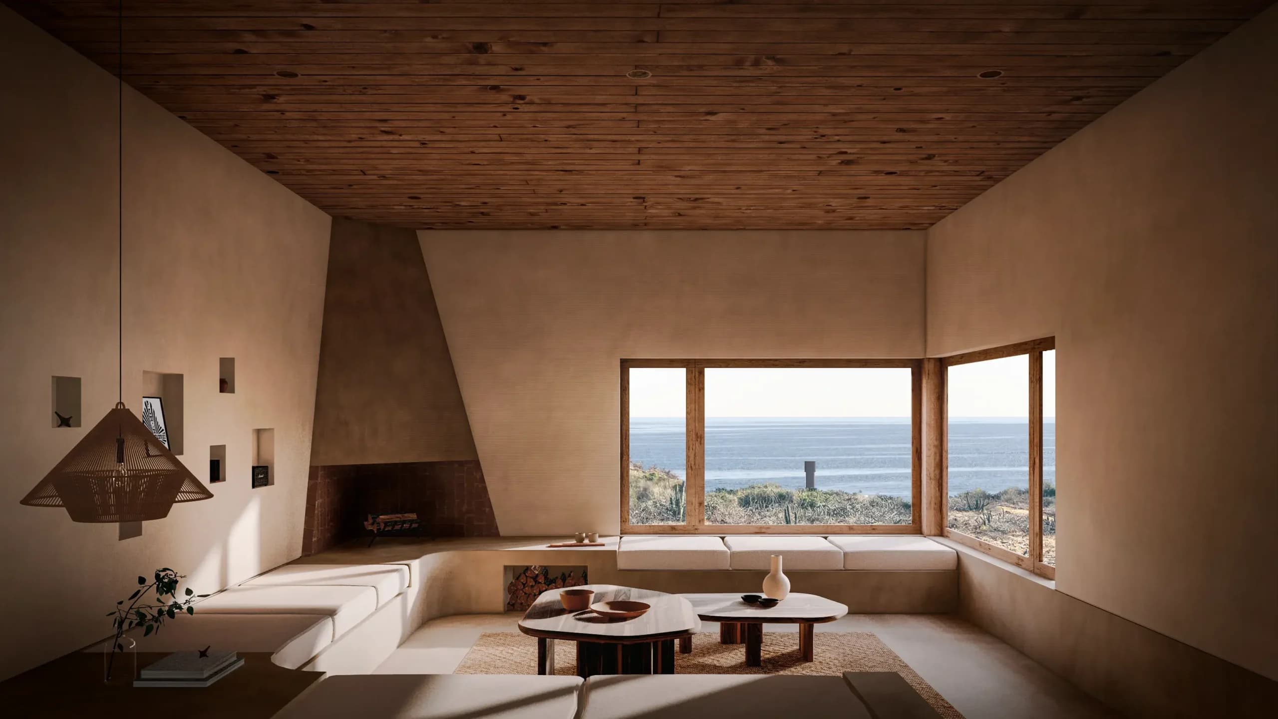
Terrain First: How the Land Defines Architecture in BCS
The most reliable sign that an architect doesn't know BCS well is a design that could be placed anywhere on any lot and work the same way. Symmetrical, self-contained, generic — the same floor plan mirrored on a coastal cliff, a desert flat, and a hillside overlooking an arroyo.
That's not architecture for this place. It's architecture placed in this place, which is different.
The terrain of Baja California Sur is complex, varied, and specific. An arroyo lot carries different constraints and opportunities than a cerro (hill) lot. A flat coastal plot faces different wind and sun exposure than a protected inland valley. A lot with sea views and a lot with mountain views require completely different section geometries to use them well.
I don't design a building until I understand a site deeply. The first site visit is more important than the first design meeting.
What site analysis in BCS actually involves
When I walk a site for the first time, I'm not taking photographs of the view. I'm reading a set of conditions that will drive design decisions before I open a drawing program.
Topography and drainage. In BCS, ephemeral drainage — arroyos, seasonal watercourses, and diffuse sheet flow paths — is the primary hazard to any building. A storm event that drops 40mm in two hours generates enormous runoff volumes from the rocky, low-absorption soil of the Sonoran Desert. Every site has drainage patterns, and every building has to either be placed out of these paths or designed to accommodate them.
INEGI topographic maps and drone surveys help, but there's no substitute for walking the site after a rain and observing where water flows, where it pools, and where it carves channels. On many lots in BCS, the arroyo drainage zone is legally regulated — CONAGUA defines buffer zones (zonas de protección) around classified watercourses that restrict construction. Designing without this information can result in a building positioned in a zone where it can never receive permits.
Solar orientation and shadow mapping. At 23°N latitude, BCS has intense direct sun from the east, overhead at noon in summer, and low in the southern sky in winter. For any given site, I map what the surrounding terrain does to solar access: Does a cerro to the west block the afternoon sun (desirable in summer, less so in winter afternoons)? Does an existing structure to the south cast shadow on part of the lot at times critical for indoor light? Does a hillside slope face west, meaning the land surface absorbs intense afternoon radiation that radiates back to any building on it?
These questions change the floor plan. A building on a west-facing slope needs much more aggressive shading and thermal mass than the same building on a north-facing or flat site.
Prevailing winds and microwind. The dominant wind in most of BCS's southern peninsula is from the northwest, particularly during afternoon hours. But terrain modifies this substantially. A property in a valley between two ridges may experience funneled winds from a different direction. A coastal cliff site may have strong onshore flow from the southwest in the morning. A sheltered arroyo site may be calm when an open mesa nearby is windy.
Understanding the actual wind pattern at a specific site requires spending time there at different hours and seasons, or at minimum talking to people who know it. I ask neighbors, I talk to local ranchers, I cross-reference with CFE weather station data for the region. This is not overcomplication — it's the information that determines how I orient the building for natural ventilation, which determines whether it needs full-time air conditioning or not.
Geology and soil bearing capacity. BCS terrain is geologically active. The peninsula sits between the Pacific Plate and the North American Plate, with active fault systems that produce seismic events regularly. Soil conditions vary from solid volcanic rock (excellent bearing, minimal settlement risk, expensive to excavate) to decomposed granite (good bearing, relatively easy excavation) to sandy arroyo fills (poor bearing, high compressibility, requires engineered foundations).
Before I design a foundation, I want a soils investigation — at minimum a manual test at proposed column locations, and for complex or uncertain sites, a formal geotechnical report with bore samples. This is standard in responsible practice and is required by Los Cabos municipality for certain project types. Not all architects push for it because it adds cost and time. The alternative is designing a foundation blind and hoping the assumptions are correct.
Existing vegetation. On any BCS site with endemic vegetation, the existing plant community is a resource to understand before touching. A cardón that took 80 years to reach 6 meters cannot be replaced. A dense cluster of torote and palo verde around a natural water seep creates a microclimate that might be the most valuable feature of the lot. Endemic vegetation can also indicate drainage patterns — certain species concentrate along ephemeral water paths; their presence tells you where water moves.
BCS law protects endemic cactus (cardón, pitahaya) and prohibits removal without permit. I treat all significant existing vegetation as fixed elements that the architecture needs to design around, not through.
Hillside lots: the geometry of section
A hillside lot in BCS is the design condition with the most options and the most ways to get it wrong.
The temptation on a steep site is to cut into the hillside, create a flat platform, and build a conventional flat-platform house on it. This generates massive excavation, destabilizes the hillside, creates retaining walls that require ongoing maintenance, and positions the building in excavated earth rather than on natural grade. In a seismic zone, deep cut slopes increase risk. In a drainage context, the cut intercepts natural runoff paths and creates concentrated water management problems.
The more intelligent response to a hillside is to design in section — to let the building follow the terrain through a sequence of levels, terraces, or split sections that reduce excavation while creating spatial interest and preserving the terrain's natural stability.
A building that steps with the hillside:
- Minimizes cut and fill, preserving terrain stability
- Creates multiple floor levels with different views and lighting conditions
- Integrates into the landscape visually rather than sitting on top of it
- Generates natural cross-section ventilation opportunities (lower intake openings, upper exhaust openings use stack effect through the building's own height)
The structural approach for hillside construction in BCS: concrete frame on isolated or spread footings positioned on stable bearing stratum, with walls that step with the terrain rather than requiring uniform excavation. On rocky hillsides, we sometimes use the exposed rock as a design element — walls that emerge directly from the stone face, interiors that open to carved rock surfaces.
Arroyo lots: proximity, regulation, and opportunity
The most misunderstood terrain type in BCS development is the arroyo lot — a lot adjacent to or containing a seasonal watercourse.
The risk: Arroyos carry intense, fast-moving floodwater during storms. The debris flow in a major BCS arroyo during a hurricane-associated rain event can include boulders, fallen trees, and uprooted vegetation moving at velocities that damage or destroy buildings in the flow path. Historically, arroyo flooding has damaged a significant number of structures in Los Cabos.
The regulation: CONAGUA classifies arroyos and defines buffer zones based on channel width and hydrology. These buffer zones restrict construction and may require hydrological studies and authorization from CONAGUA before any permit can issue. Working without this authorization in a classified arroyo zone is not just a legal risk — it's a safety risk.
The opportunity: An arroyo lot, properly understood and used, is often the most beautiful site type in BCS. The arroyo corridor concentrates endemic vegetation — the desert oasis effect. Date palms, fig trees, fan palms, and dense native understory grow along arroyo paths in ways they don't on the open desert. The channel geometry creates topographic interest, shade, and a sense of enclosure. The arroyo is visually and ecologically rich.
A building positioned correctly relative to an arroyo — on the high ground at the edge of the regulatory buffer, elevated above the 100-year flood line, oriented to frame the arroyo vegetation as the primary view — uses the site's best feature without putting the building at risk.
Coastal and sea-view lots: view, wind, salt, and setback
Coastal lots in BCS are among the most valuable and most demanding.
ZOFEMAT setback: The Zona Federal Marítimo Terrestre begins at the high-tide line and extends 20 meters inland. This federal zone cannot be built on without a concession (concesión de zona federal) — a permit from SEMARNAT that is separate from municipal building permits and considerably harder to obtain. The construction setback from the ZOFEMAT line is typically an additional 5–10 meters depending on municipal regulations and environmental conditions.
Understanding exactly where the ZOFEMAT line is on a specific lot requires a deslinde (formal survey and demarcation) conducted by an authorized surveyor. The line can move after major storms that shift the beach. Building without a clear ZOFEMAT definition is a significant legal and practical risk.
Sea wind and salt: Within 500–800 meters of the ocean, buildings are exposed to persistent salt-laden air. Salt aerosols accelerate corrosion of metal elements (fasteners, structural connections, window frames, roofing), degrade paint and organic coatings, and attack concrete surfaces over time. Designing for coastal exposure in BCS means:
- Specifying marine-grade or stainless fasteners and connectors throughout
- Using concrete mixes with low water-cement ratio and adequate cover over reinforcement
- Selecting window and door hardware rated for marine environments
- Choosing exterior finishes that perform under salt exposure (lime-based renders handle salt aerosols better than synthetic stucco)
- Designing drainage to prevent salt accumulation at wall bases
Views and orientation: The dominant view condition (ocean, mountains, arroyo, or interior landscape) is often not aligned with the climate-optimal orientation. On a west-facing coastal site with Pacific Ocean views, the primary view is directly into the afternoon sun from May to October — the worst heat gain condition.
The architectural solution isn't to ignore the view or to shade it out. It's to capture the view through calculated openings: deep overhangs that allow view out but block direct solar entry at low-sun angles; horizontal fins above glazing that allow view at eye level but block the high afternoon sun; covered terraces that frame the view from a shaded position rather than from exposed glass.
Flat lots: where orientation is your only variable
A flat lot in the BCS interior or coastal flat gives you complete freedom — which means every orientation decision is a deliberate choice with no terrain constraint to help you make it.
Flat lots allow for the full range of passive design strategies: optimal solar orientation, courtyard organization, linear building forms aligned with prevailing breezes, and landscape design that creates microclimates on all sides.
The risk on a flat lot is the blank-page problem: freedom produces generic results when the architect doesn't have a strong climate-driven planning logic. On a site with no topographic constraints, the temptation is to center the building, orient it symmetrically, and let it sit in the landscape without a strong relationship to sun or wind.
The best flat-lot projects I've done start with a wind map and a sun diagram and work outward from there — positioning the building to maximize the prevailing breeze corridor through the site, locating the courtyard as the airflow collector, and placing landscape elements to create shade on the critical western exposure before the building even needs to manage it.
Site analysis before design: always, without exception
I'm going to end on this point because it's the one I consider non-negotiable.
I have never visited a site in BCS and found nothing that changed my thinking about how the building should respond to it. Never. Every site tells you something that the survey plan or the topographic map or the satellite image doesn't. The direction the arroyo runs, the neighbor's wall that casts an unexpected shadow at 3pm, the prevailing breeze that comes from the east rather than the northwest on this particular lot because of a canyon to the north, the way the volcanic rock comes to grade in the northwest corner and determines exactly where the foundation can go efficiently.
A building designed without this knowledge is a building designed for an abstraction. In BCS, abstractions don't survive contact with the terrain.
Schedule a free consultation → info@symbioticarq.com
Symbiotica
Ready to start your project?
Free 60-minute consultation — no commitment required.